“It’s hard to imagine that Boston’s trendy South End, with its brick and brownstone townhouses, tree-lined streets, brick sidewalks, parks, playgrounds, and community gardens, was originally a narrow strip of land, the Boston Neck, connecting Boston to Roxbury and surrounded by a tidal marsh. Prior to the 1840s, the area included only a few mansions, set in open fields. In the 1840s, however, because Beacon Hill and the downtown area were overcrowded, the city added land to the Neck by filling in the marshy areas with earth imported from Needham, Massachusetts, to form the area now called the South End.”
— Arlene Vadum, A Short History of Boston's South End
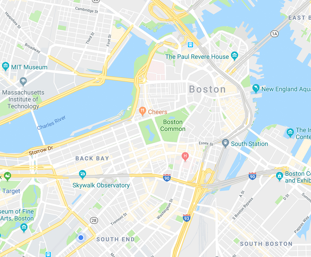
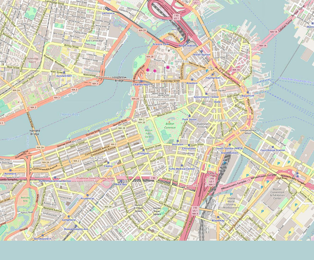
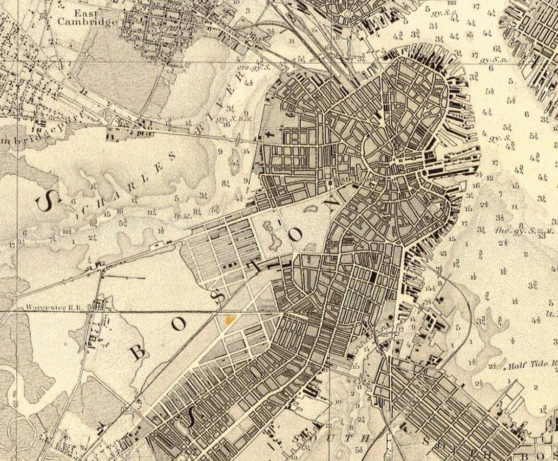
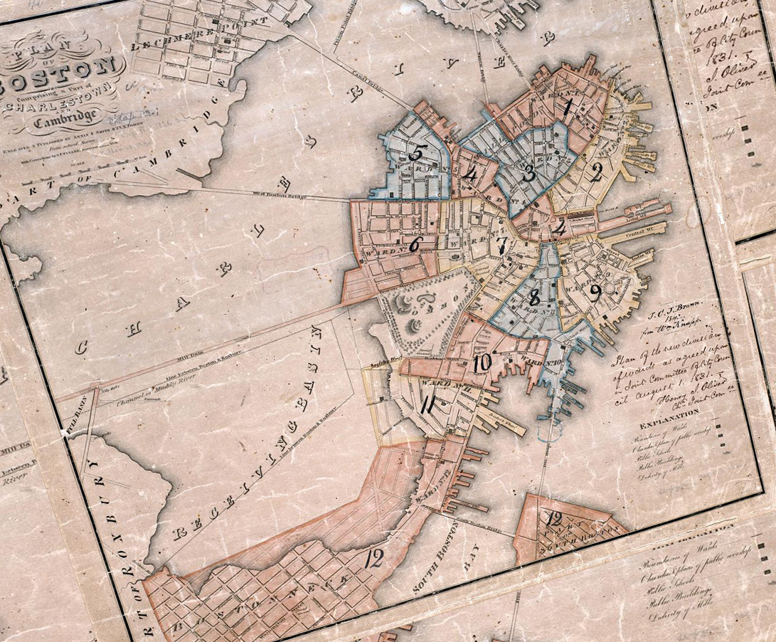
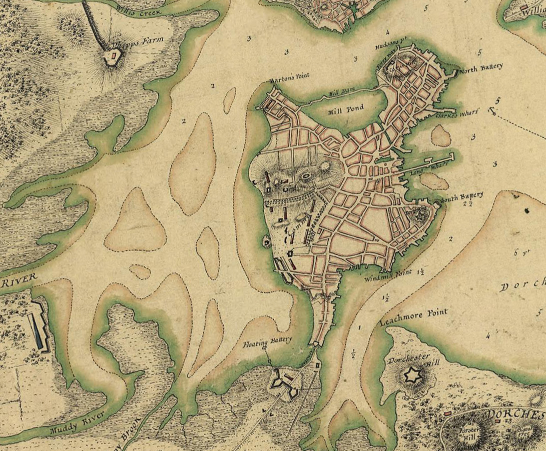
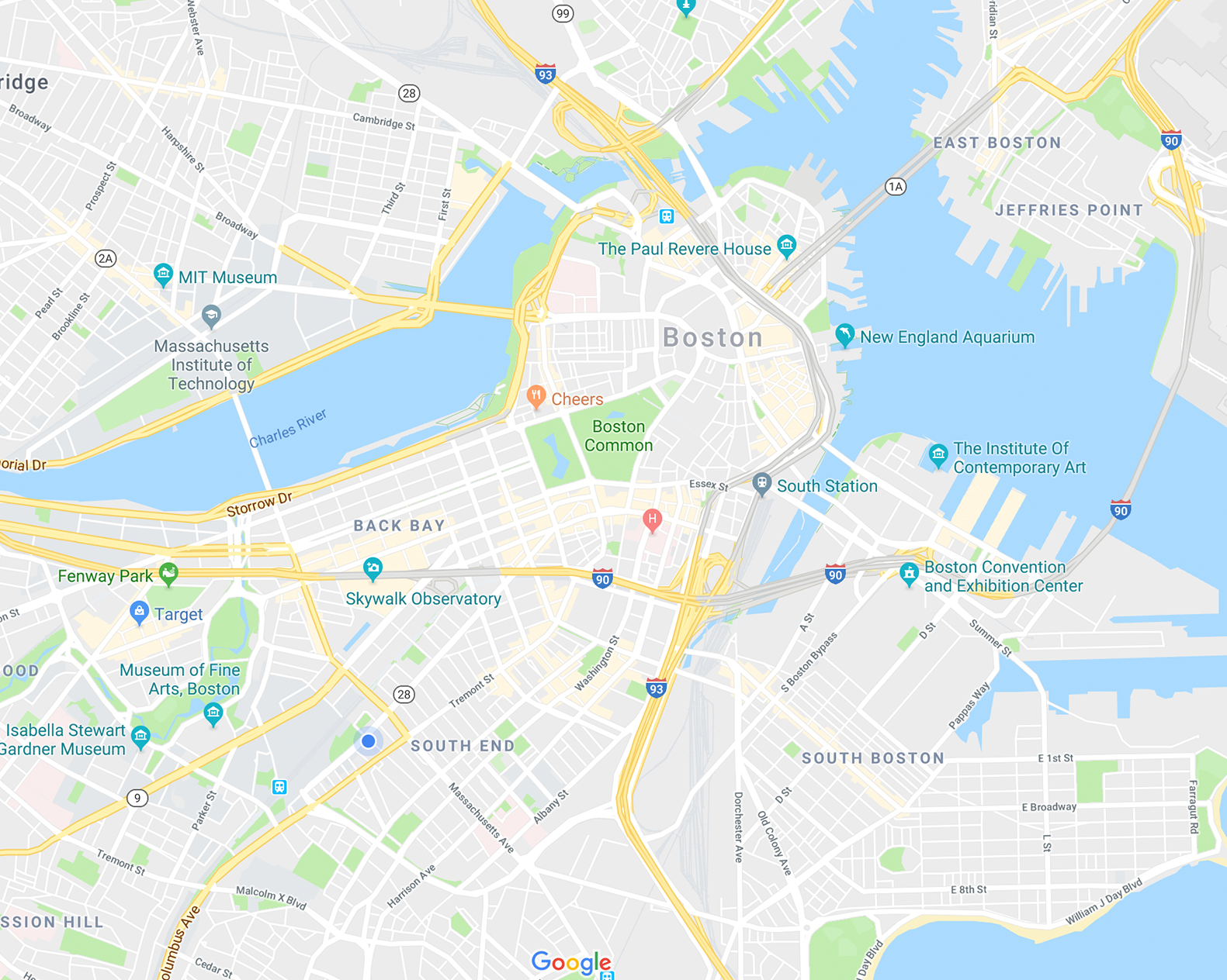
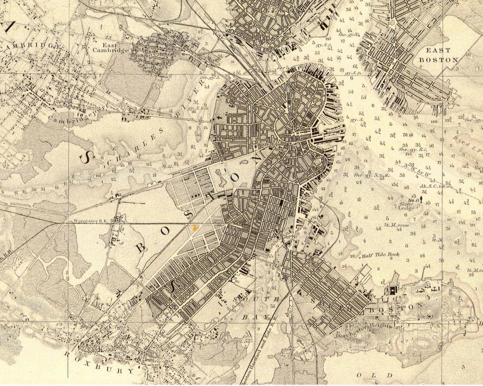
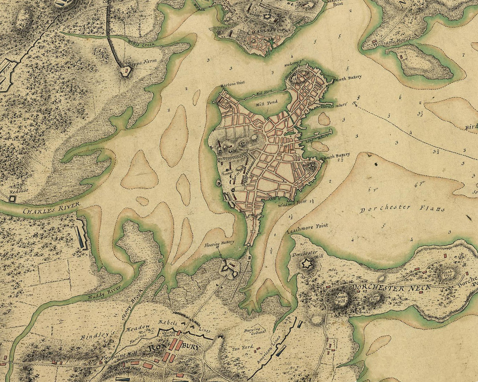
Click the maps to watch Boston's geography progress to the current day!
Boston Maps
Three maps of the Boston area spanning 1775 to 2017, with the South End's progression visible in the bottom-middle left corner.
Map Details
A detailed look at the three maps above, and two additional smaller maps that feature 1826 and a detailed 2017.